You are using an out of date browser. It may not display this or other websites correctly.
You should upgrade or use an alternative browser.
You should upgrade or use an alternative browser.
Taking armchair hunting to new heights
- Thread starter David_S
- Start date
Vt.birdhunter
New member
I gotta figure out how Im gonna get one of those up into my tree-stand")
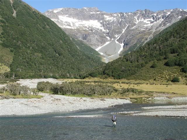
Spectacular country; truly.
Spectacular country; truly.
grubbylabs
New member
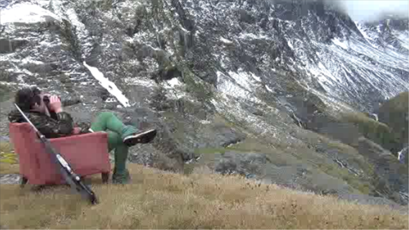
I like the muzzle right next to his head, must make for quick human kill.
OK David_S now that's funny, But what's up with the pants? Going for a Robinhood men in tights look?
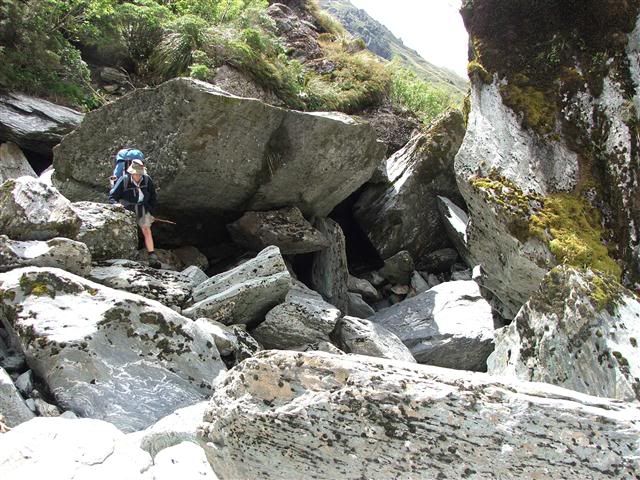
Not really. Actually they are polyprop long johns worn under shorts. It's a practical arrangement fairly common here, which protects your legs form cold, wind, sandflies and scratches, does not drag when wading through rivers and dries out quickly. We actually choppered in to this spot and then took 5 solid days to walk out, through some pretty tough country. At one stage we progressed no more than 100 yards in an hour!
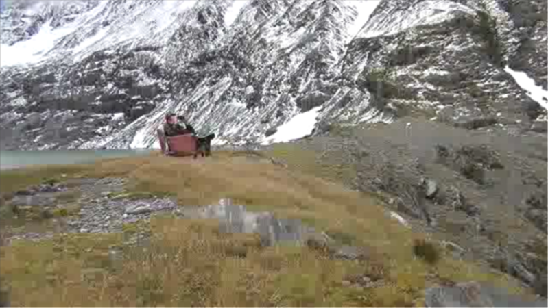
This was the "easy" country
and this the hard
David
checkmyswag
New member
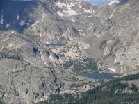
Beautiful country. Here's where I was in the Rockies. Saw an elk on the continental divide!
 Weminuche Wilderness
DAVID S, What were you hunting nothing very big I hope.
5 day pack out,cant imagine THE effort it would take on red stag or large goat. If so you are my new HERO!!!
Checkmyswag, What do you hunt above the tree line? Just wondering I've never been that high before. About 9000 ft is it for me cant hardly breath then. There is alot of difference in the air here than there.
Last edited:
DAVID S, What were you hunting nothing very big I hope.
5 day pack out,cant imagine THE effort it would take on red stag or large goat. If so you are my new HERO!!!
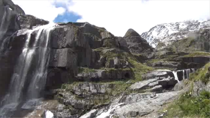
Actually we really went to see the country. The upper reaches of the valley where we were dropped off do contain small numbers of chamois and tahr and as my son (in the armchair) has never shot a tahr we took the Sako along for a walk just in case. Unfortunately we lost a day because of bad weather and, probably fortunately (?), we saw little sign of animals until we reached the lower country where there was lots of fresh deer sign but we left them alone as we have deer and chamois closer to home in slightly easier country.
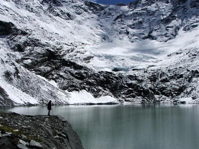
The rifle was the proverbial PITA in the scrub, and also the ice axe which we took along to explore the glacier at the head of the lake. At least we used the axe and also the rope but all the Sako received was a lot of scratches.

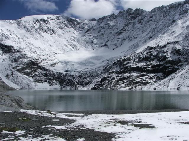
I still reckon I qualify as a hero as I think it was not a bad effort for a guy past 65. But the lake and glacier were stunning.
David
checkmyswag
New member
Hunting there would be a wonderful trip whether you shot a trophy or not. Gorgeous.
fatwhiteboy
New member
Wish I was younger.
Thanks for your comments. I am really fortunate in having this country so close to home and a son who enjoys coming with me. As the years have passed his pack has grown heavier and mine lighter (sort of!). This was the first time we had chartered a helicopter as we realised there was no way we could reach the glacier and return in a week. Well worth the money. As we flew in I looked down at the "hard" gorge and thought "sh*t"!
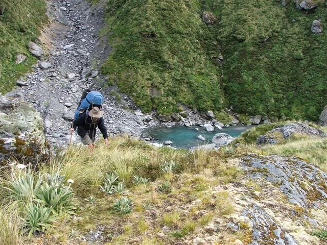
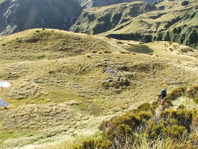
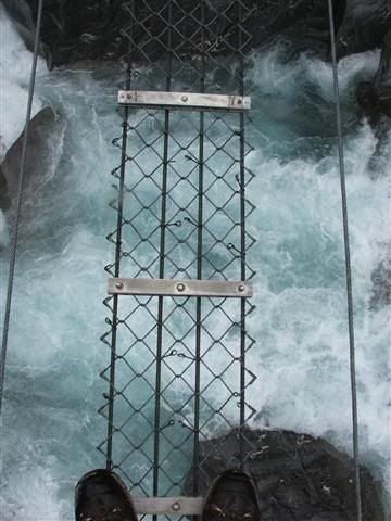
The country changed as we got lower. First open tussock basins, then scrub, then thick bush with the river going through 3 gorges. Once we were through the scrub we picked up an old unmaintained track which had had some volunteer clearance and marking done on it. It was still pretty hard going as there was a lot of windthrow and the track sidled above the gorges with several nasty washouts where you did not want to look down and where we used the rope. Fortunately the old swing bridge was still in place or we would never have got across the river.
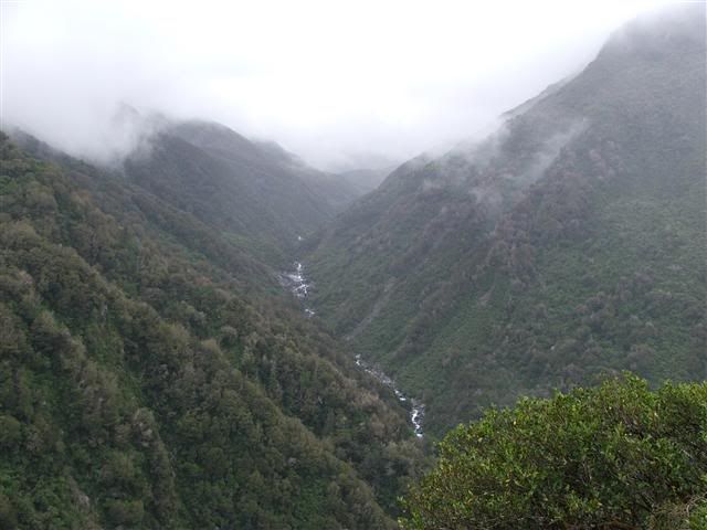
The upper tussock terrain.
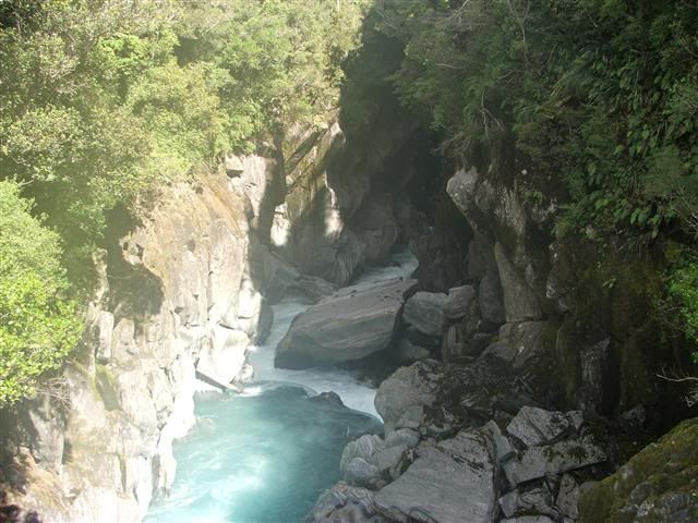
One of the gorges
The bridge
A washout
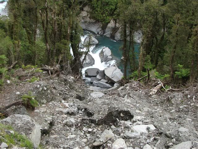
A typical side creek
And back closer to home where we had got "fit" by climbing to the top of the snowfield at 6,500ft. Surprisingly this was actually 1.500ft higher than the glacier we later flew to.
Enjoy. David
The country changed as we got lower. First open tussock basins, then scrub, then thick bush with the river going through 3 gorges. Once we were through the scrub we picked up an old unmaintained track which had had some volunteer clearance and marking done on it. It was still pretty hard going as there was a lot of windthrow and the track sidled above the gorges with several nasty washouts where you did not want to look down and where we used the rope. Fortunately the old swing bridge was still in place or we would never have got across the river.
The upper tussock terrain.
One of the gorges
The bridge
A washout
A typical side creek
And back closer to home where we had got "fit" by climbing to the top of the snowfield at 6,500ft. Surprisingly this was actually 1.500ft higher than the glacier we later flew to.
Enjoy. David
Last edited:
Any contact with the real world in case you got hurt or you were just out of luck....
You take the normal precautions. Write intentions in hut books if staying in huts; let someone know in writing where you are going, alternative routes and when you are due out etc. with instructions as to what to do if you don't report in. Most likely reason for a delay is heavy rain causing creeks and rivers to rise. You then have no option but to hole up in camp or preferably a hut if one is handy.
No communications though, unless you want to pack a heavy HF mountain radio. However we always carry a small emergency personal locator beacon (PLB). When activated this broadcasts our GPS co-ords and PLB identification, and alerts the National Rescue Co-ordination Centre who should then call any of three people they have listed as contacts for that particular PLB. If that person confirms that we are hunting or hiking in the area of the distress signal they will assume it is not an accidental triggering and will alert the police who are in charge of land search and rescue.
The last thing my son and I want to do is to trigger a LandSAR operation as we are both volunteer members and would never live it down.
 When walking we often leave deliberate sign to help LandSAR searchers in an emergency.
David
PS The Rockies look nice. Very glaciated. How do I get there?